
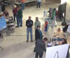
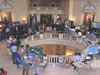
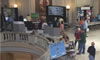
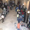
GIS Day at the Capitol
2011 Photos |
Click on the photo to see a larger version.
4_H_Program.JPG |
4_H_Program_2.JPG |
4_H_program_3.JPG |
Benchmark_GPS.JPG |
Carter_County_City_Ardmore.JPG |
Cherokee_Nation_2.JPG |
Chesapeake.JPG |
Chickasaw_Nation.JPG |
Chickasaw_Nation_2.JPG |
|

city_ardmore.JPG |
City_ardmore_2.JPG |
City_Midwest_City.JPG |
city_okc.JPG |
city_okc_2.JPG |
crowd_1.jpg |
crowd_10.JPG |
crowd_11.JPG |
crowd_12.jpg |

crowd_2.JPG |
crowd_3.JPG |
crowd_4.JPG |
crowd_5.JPG |
crowd_6.JPG |
crowd_7.JPG |

crowd_8.JPG |
crowd_9.JPG |
CSA.JPG |

CSA_2.JPG |

ENERCON.JPG |
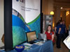
ESRI.JPG |
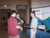
ESRI_2.JPG |
GIS_Certification_Institute.JPG |
Meshek.JPG |
Meshek_2.JPG |
MNTC.JPG |
Muscogee_Creek_Nation.JPG |
ODAFF.JPG |
ODMHSAS.jpg |
ODMHSAS_2.JPG |
ODOT.JPG |
ODWC.JPG |
ODWC_2.JPG |
ODWC_3.JPG |
OKDEQ.JPG |
OKLANENA.JPG |

OKLANENA_2.JPG |
OK_Biological_Survey.jpg |
OK_Biological_Survey_2.JPG |
OK_Biological_Survey_3.JPG |
OK_Conservation_comm.JPG |
OK_County_Assessor.JPG |
OK_County_Assessor_2.JPG |
OK_County_Assessor_4.JPG |
OK_Dept_Commerce.JPG |
OK_Dept_commerce_3.JPG |
OK_Dept_Health.JPG |

OK_Dept_Health_2.JPG |
OK_Geological_Survey.JPG |
OK_NaturaL_Areas_Registry.JPG |
One_Call.JPG |
OWRB.JPG |
OWRB_2.JPG |
OWRB_4.JPG |
Pinnacle.JPG |

R7_Solutions.JPG |
Red_Plains.JPG |

Rogers_County.JPG |
SAIC.JPG |
SAIC_2.JPG |
Sanborn.JPG |
SCAUG.JPG |

Surdex.JPG |
Tinker.JPG |
Tinker_2.JPG |
USGS.JPG |
USGS_2.JPG |
US_Census.JPG |

US_Census_2.JPG |
Villa_GIS.JPG |
Villa_GIS_2.JPG |
Western_Data.JPG |

Wilson_&_Company.JPG |